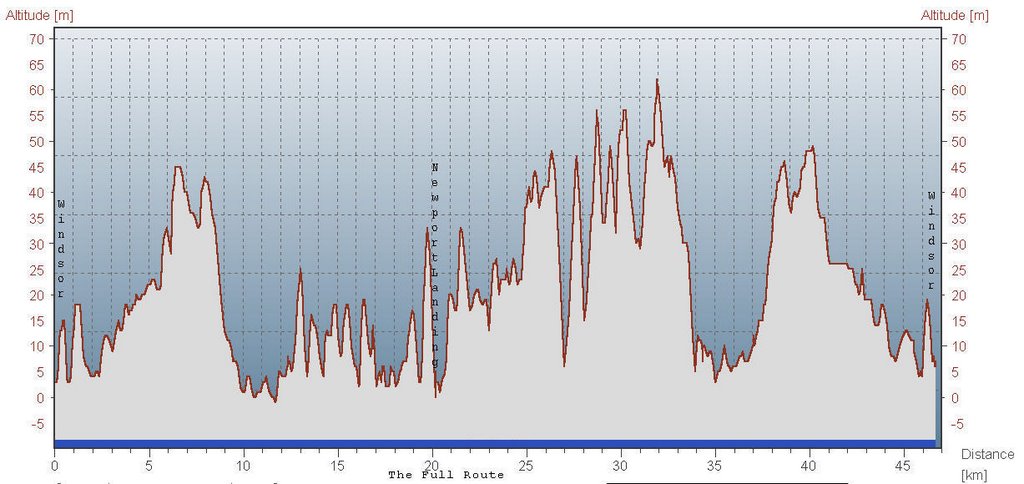
October 7 part 2, Hantsport to the famous Grape Stomp
Picking up where I left off yesterday...
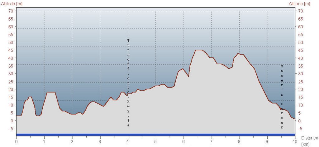
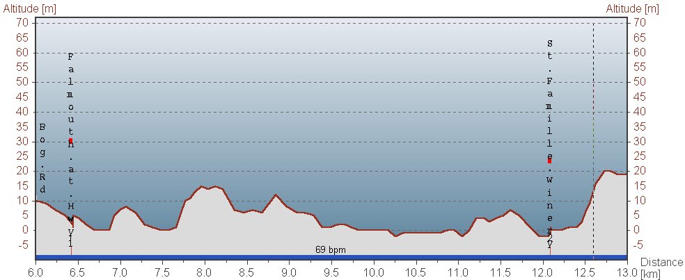
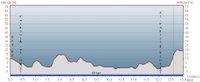 Falmouth from Bog Road to St Famille Winery (where we paused but didn't go in yet)
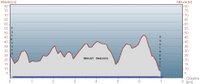
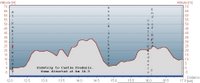 The side-trip to Castle Frederick. A small splinter group turned off partway through and went somewhere else instead. But heck, we're flexible...
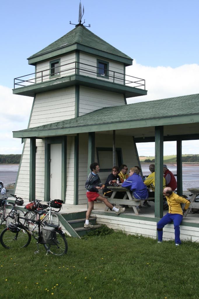
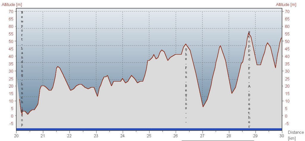
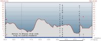 Return from Castle Frederick to the Winery, with a whimsical look at a grassy floorplan of the old Globe Theatre, London. This time we did go into the Winery for the party, and a fine time was had, with much sampling of darn near everything. Eventually our Stomp team got up to smush some grapes.
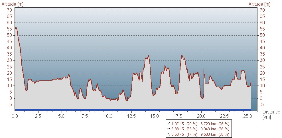
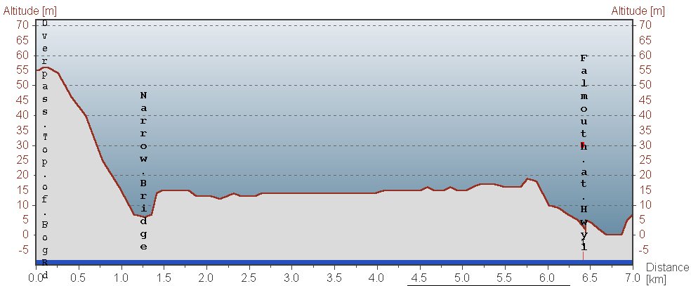
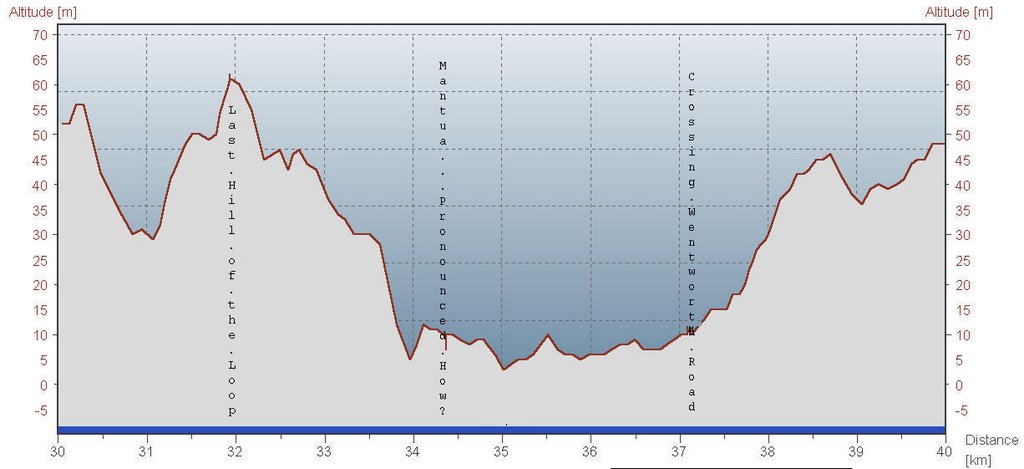
 The first part of the return trip: Winery to Highway 1, at which point I split off from the group and headed home. If my bike seemed to want to wander over the road a bit, I swear it was an inner-ear balance issue caused by residual effect of the band's volume. Although I was forcibly reminded when I started up the climb to Ardoise from Newport Corner, that there is nothing like a tad of red wine to turn the thighs to rubber. So it was a long, slow crawl to home.
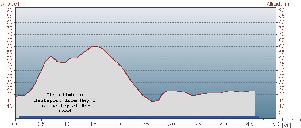
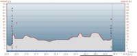
 From an earlier ride I did this year, Falmouth to Hantsport staying on Highway 1 via Mount Denson.
 Falmouth from Bog Road to St Famille Winery (where we paused but didn't go in yet)
 The side-trip to Castle Frederick. A small splinter group turned off partway through and went somewhere else instead. But heck, we're flexible...
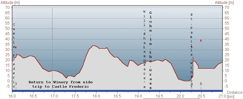 Return from Castle Frederick to the Winery, with a whimsical look at a grassy floorplan of the old Globe Theatre, London. This time we did go into the Winery for the party, and a fine time was had, with much sampling of darn near everything. Eventually our Stomp team got up to smush some grapes.
 The first part of the return trip: Winery to Highway 1, at which point I split off from the group and headed home. If my bike seemed to want to wander over the road a bit, I swear it was an inner-ear balance issue caused by residual effect of the band's volume. Although I was forcibly reminded when I started up the climb to Ardoise from Newport Corner, that there is nothing like a tad of red wine to turn the thighs to rubber. So it was a long, slow crawl to home.
 From an earlier ride I did this year, Falmouth to Hantsport staying on Highway 1 via Mount Denson.
posted by Leo at 2:59 PM
0 comments
![]()
![]()